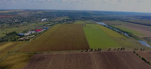
Greenfield, Ciadâr-Lunga subzone

Ceadir-Lunga subzone is located in the northern part of Ceadir-Lunga Municipality in the proximity of 3 km from the city center. The greenfield land plot of 42 hectares is situated in immediate proximity to the existing industrial zone of the municipality. The subzone has connection to National roads R36 (Basarabeasca – Ceadîr-Lunga – Taraclia) and R37 (Ceadîr-Lunga – Comrat – Cantemir), and railway route connecting the municipality with Basarabeasca (railway customs crossing point with Ukraine) and Blank See port on Danube River.

Location Ceadîr-Lunga
Population 20000 inhabitants
Overall Population of Autonomy 162,000 inhabitants
Total Area of the City 17 sq. km
Organizational Form FEZ administration
Land Ownership Public
Land Destination Construction
Total Land Area 50.3 hectares
Free Buildable Area 20 hectares

Transport

Immediate access to European route E583 – B class road connecting the cities Roman (ROU) and Zhytomyr (UKR), which is national magistral road M3 Chisinau – Cimislia – Vulcanesti – Giurgiulesti (MDA) – border checkpoint with Romania.

Distances:

  • 100 km to Chisinau
  • 80 km to the nearest border checkpoint with Romania
  • 30 km to the nearest border checkpoint with Ukraine

30 km to Basarabeasca railway customs crossing point with Ukraine.

100 km to Chisinau International Airport.
Giurgiulesti International Free Port is located at circa 135 km distance from Vulcanesti. It is the only Danube River and Black Sea port in Moldova with direct access to international waterways.

Utilities

Water supply:

wells (50m3/hour), piplene in development.

Electric power:

transmission line, substation in development.

Natural gas:

Medium pressure gas pipeline 0.155-0.25 MPa

Sewerage:
in development.
Available:
Master plan